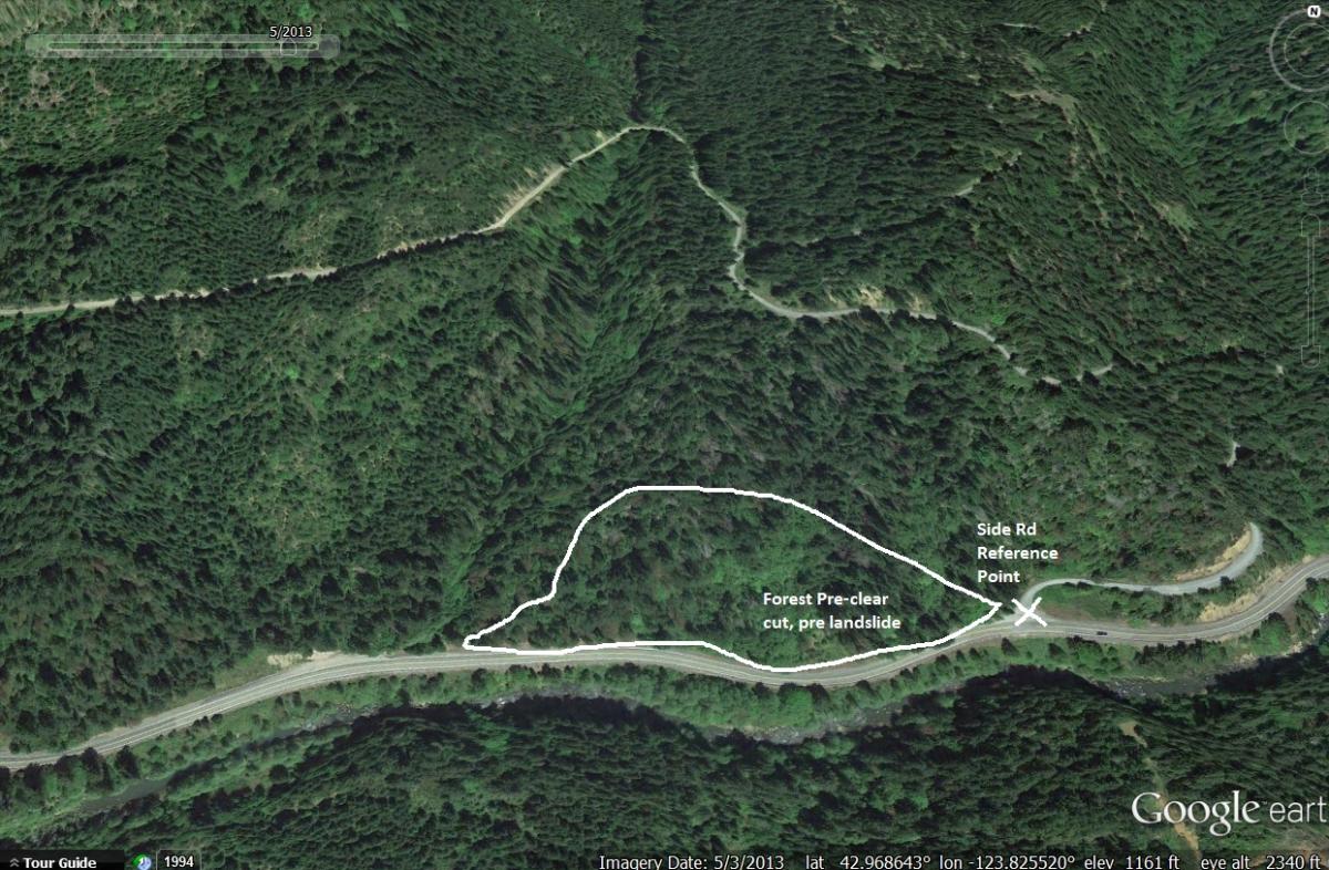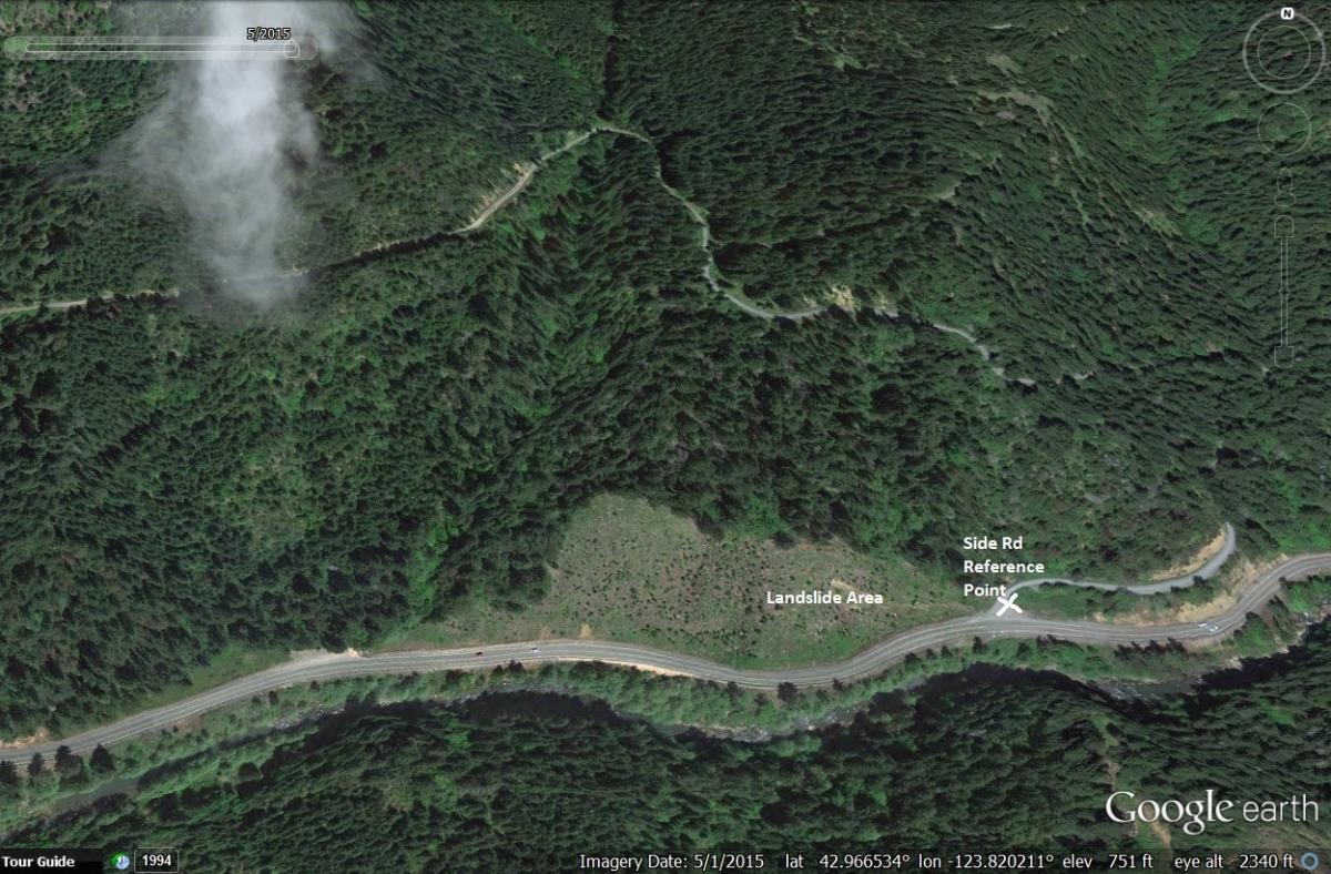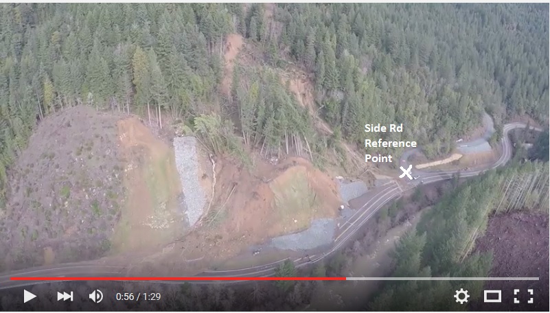
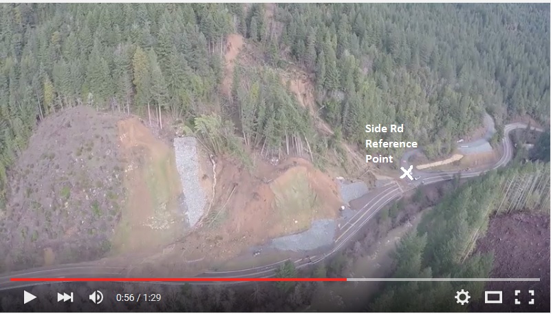
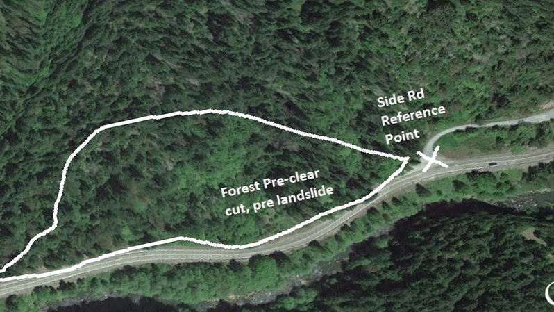
 Satellite images from Google Earth and footage released this week from the Oregon Department of Transportation suggest that a recent clearcut on a slope above Highway 42 may have contributed to its instability. According to the satellite imagery, the slope was logged between May 2013 and May 2015 (full images below).
Aside from scarring the landscape and altering forest conditions for habitat and healthy streams, clear-cuts pose a greater risk for landowners in the form of mudslides. In 2009, the Seattle Times did an investigation of causes of landslides. Read it here. Keep in mind that Washington's rules for logging are stricter than in Oregon, yet this still happens there.
Scientists have long known that clear-cutting can disrupt the stability of soil and expose hillsides to greater amounts of rainfall, increasing the risk of a catastrophic landslide. Check out a summary of the science here.
The same storms that triggered the Highway 42 landslide contributed to a fatal landslide near Florence and devastating landslides all along the Oregon Coast. On Oregon's North Coast, a state of emergency has been declared and local residents tell us they are stuck in flooded neighborhoods with landslides closing roads all around them. Oregon Wild is monitoring the situation closely, and believes the State of Oregon should conduct its own thorough investigation and take action to protect Oregonians from the dangers of clearcuts on steep slopes.
If you see land sliding off of clearcut lands near you, and you can safely and legally take photos, please contact Jason Gonzales at Oregon Wild. He can be reached at [email protected] or 541-3440675