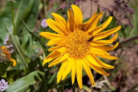
On June 29, 2014 , I co-led an Oregon Wild and Klamath Siskiyou Wildland Center wildflower hike to a 5400 to 5900 foot southern Cascades botanical hot spot just outside of Ashland called "Grizzly Peak”. Around 300 flowering plants have now been identified in this area of western Oregon BLM lands. One of the featured wildflowers on the way in is Cimicifuga elata, Tall Bugbane, growing here at the southern-most end of its geographic range. Below are photos of just some of the wildflowers to be found on this hike.
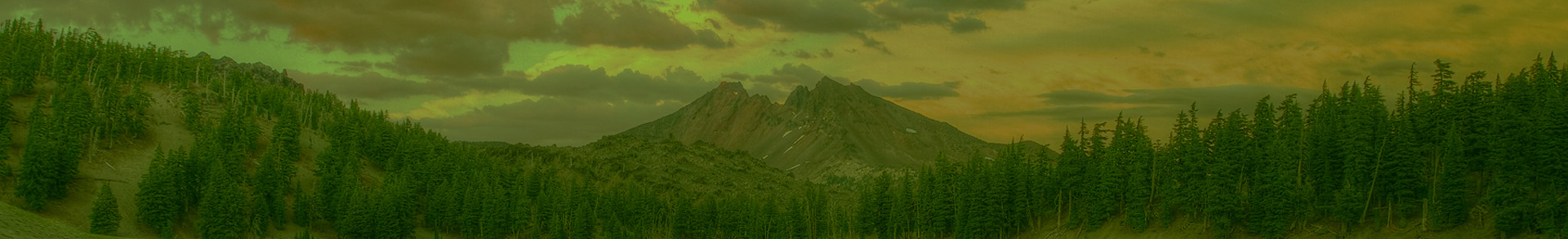
 Grizzly Peak is scenically stunning, partly why it’s included in the proposed Crater Lake Wilderness. But because this area is not currently Wilderness, this pristine wildland remains unprotected from logging and development. There is a diversity of old growth white fir forests, lush understory wildflowers, wet and dry meadows, rock outcrops, and frequent scenic views well interspersed.
Along the trail, not just on top, you can see the Crater Lake Rim and Mt. Thielsen, and to the east Mt. McLoughlin. You look right out at Mt. Shasta to the south, and much of the hike contains views across the entire Rogue Valley--Table Rocks, Mt. Ashland and beyond.

It's an easy to moderate 5.1 mile hike to do the full loop at Grizzly Peak--with most of the initial, gradual uphill hiking in a cool shaded forest. The “loop” is a total of approximately 3 miles, with a 1 mile connector trail in and out.
The drive to the trailhead is easily done in a low clearance vehicle—on a paved road all the way to the trailhead—and where there is also an outhouse. The far northwest end of the loop hike of about 1.5 miles is through a fire recovery area, from a fire that burned years ago.
Directions:
From Interstate 5, take the south Ashland exit number 14. Turn east away from town. Follow Highway 66 for less than a ¼ mile. Turn left on Dead Indian Memorial Highway. Follow this road approximately 7.0 miles to the Shale City Road, marked 38-2E-27. (This road will occur before you reach the evergreen forests on top.) Look for the Grizzly Peak trail signs. Turn left. Follow the Shale City road approximately 3.0 miles until you reach road number 38-2E-9.2. Look for Grizzly Peak trail signs. Turn left onto this road. At approximately 1.0 mile on this road, you will come to a three way junction. Follow the road leading uphill, which will be the same road you are on. Look for the Grizzly Peak trail signs. Approximately 1.0 mile further, you will reach the trailhead. Here, parking is available at the trailhead on two tiers for about 20 vehicles.