 '
'
 Twin Lakes
Umpqua National Forest
Difficulty: Moderate
Distance: 5.6 miles round trip
Elevation Gain: 800 feet
Best time to go: Usually accessible early summer to fall.
Notes: No parking fee required. Restrooms are available at the trailhead.
About this Hike
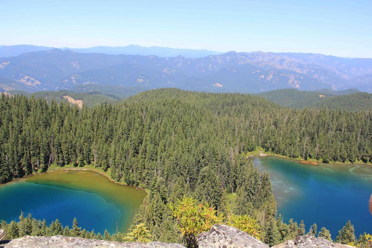
The Twin Lakes area offers a sampling of the best of the region: spectacular wildflower meadows, old-growth trees, mountain views, and ancient forests - some recovering from a 2017 fire. The trail first climbs through a mix of forest and meadows to a viewpoint of the Boulder Creek Wilderness and Diamond Peak to the north, and Mount Thielsen and Mount Bailey to the east. Patches of burned forest are spread out below, showing the pattern of mixed severity that appears at a smaller scale all along the trail.
At a signed junction just beyond a wildflower meadow, turn right toward Twin Lakes, and stay left at the next junction with the Deception Creek Trail. Continue through a wet meadow to a shelter sitting above the first lake. Turn right to follow the trail on the ridge to then join the lakeshore trail going counterclockwise. As you round the second lake, a boardwalk leads across springs and past some large boulders. Continue to the right through a wet thicket, and turn right at a split in the trail in a grove of Alaska yellow-cedar trees to return to the shelter.
Head back through the meadow to the first of the two junctions you encountered on the way in, and go straight here for the second half of this recommended hike—to the top of the cliff that rises above the lakes. The trail climbs into the burned area and in and out of dry meadows and towering forests that sport large Shasta red firs. At 1.2 miles into this segment of the hike, turn right at a trail junction on the ridgetop to reach the top of the cliff with gnarled trees and stunning views to the north and east and down over the turquoise lakes below.
Getting There
From Interstate 5 in Roseburg, take exit 124. Go through downtown Roseburg, following signs for Crater Lake/Diamond Lake and Oregon Route 138E, making first a left, then a right turn to get on Diamond Lake Boulevard. Travel roughly 50 miles east of Roseburg and turn left off of OR 138 onto Forest Road 4770 at a sign for the North Umpqua Trail and Twin Lakes just after crossing a bridge over the North Umpqua River. Follow gravel FR 4770 uphill 9.4 miles to the trailhead parking at the end of the road.