 '
'
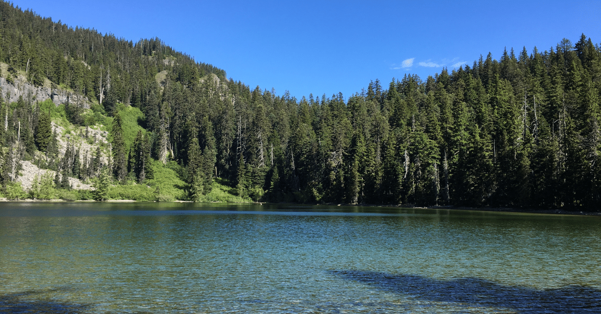 Boulder Lake
Mt. Hood National Forest
Difficulty: Easy
Distance: 1 to 3+ miles round trip
Elevation Gain: 450 feet
Best time to go: Early summer to fall. Wildflowers best in early July, late summer better to avoid mosquitos.
Notes: No parking fee required. Restrooms are available near the lake.
About this Hike
Follow the well-traveled trail from the main trailhead through a delightful forest of Douglas-fir and noble fir past tiny Spinning Lake, for just 0.4 mile to the edge of Boulder Lake. From here you’ve got options. To explore a quieter lake, turn left at the trail junction to head down the half-mile trail to Little Boulder Lake. Or, follow the lakeshore trail a half mile around. Or, turn right to stay on the east side of the lake and hike further into the forest. For this latter option, continue for 0.6 mile from the lakeside trail junction over a rise to Kane Springs, where the wet area supports big noble fir, Engelmann spruce, Pacific silver fir, and mountain hemlock. This is a great turnaround, but if you are here in late June and July and up for a more strenuous hike, consider continuing another mile (gaining significant elevation) past Kane Springs uphill past rocky slopes to Bonney Meadows, which is chock-full of wildflowers.
One other option to throw in the mix is to take the Boulder Creek Trail, across the road from the Boulder Lake Trailhead, and descend half a mile to the stream through diverse old forest to check out the proposed Wild & Scenic River.
Getting There
Travel east out of Portland on US Highway 26 toward Mount Hood, and go 3 miles east of Government Camp to take the exit for Hwy 35 north toward Hood River. Go 4.5 miles on OR 35 and cross the big bridge over the White River. Immediately after crossing the bridge, turn right onto Forest Road 48, which starts at the far (east) side of the large White River East Sno-Park at milepost 68.
Continue 14 miles on FR 48 and then turn left onto FR 4880. (There’s a sign for this road. If you see a sign for Boulder Ditch you’ve gone too far.) Stay on narrow FR 4880 for 2.5 paved miles; then stay to the right where the road splits and turns to gravel. Go another 4 miles on the bumpy road to the trailhead where the road widens for parking on the left.