
Oregon Wild uses state of the art cartography software, commonly referred to as GIS (Geographic Information Systems). Cutting edge technology allows us to accurately map all of Oregon's most treasured forests and natural areas.
Proposed Wilderness and Wild & Scenic River Maps
- Interactive map of all potential forest Wilderness in Oregon
- Potential forest Wilderness in Oregon map
- Newly Protected Nehalem River State Scenic Waterway
- Crater Lake Proposed Wilderness
- Proposed Ochoco Mountains National Recreation Area
- Proposed Mount Hood Wilderness
- Wild Rogue Wilderness Proposal Map
Wildlife Maps
- Map of Journey's (OR-7) home range as of April 2014
- Map of Oregon's Wolves, including "Journey" (OR-7)
- Wildlife Trees Map - shows overlap with roadless and wilderness
- Current and Historic Spring Chinook - Klamath River
- Proposed Wilderness areas and ODFW Wildlife Management Units
- Oregon Inventoried Roadless Areas and ODFW Wildlife Management Units
- Wild Rogue Proposed Wilderness and Elk Management Areas
- Wild Rogue Proposed Wilderness and Salmon, Steelhead habitat (USFS data)
Wilderness and Wild and Scenic River Maps
- Interactive Map of Oregon's Wild and Scenic Rivers, or pdf
- Interactive Map of the Oregon Wildlands Act of 2019
- Devil's Staircase Wilderness 2019
- Molalla Wild & Scenic River 2019
- Lewis and Clark Mount Hood final Wilderness map 2009
- Soda Mountain Wilderness map 2009
- Copper Salmon Wilderness map 2009
- Mount Hood Region map of Congressional Protections by Year
- Oregon Wilderness Protection by Year Map
Logging and Fire Maps
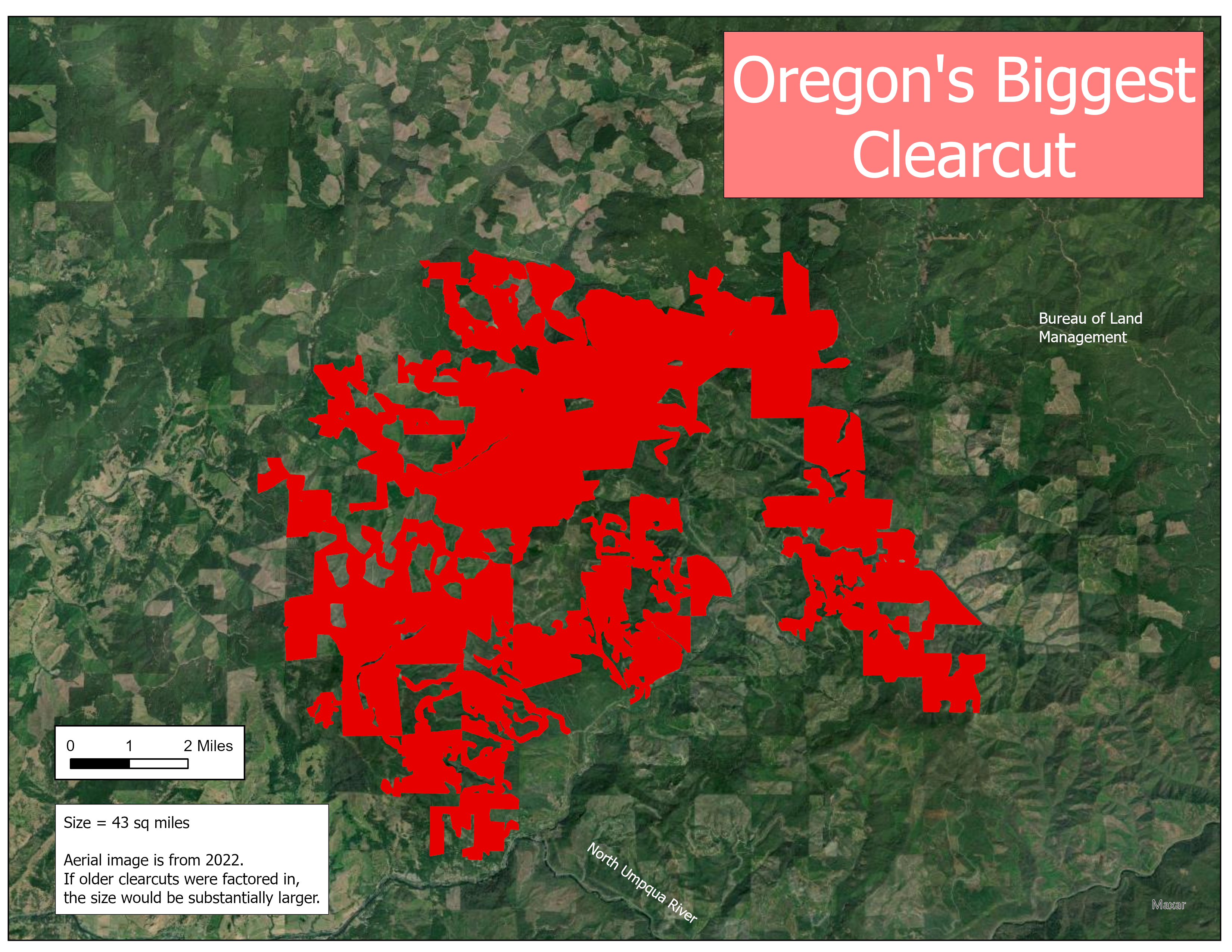
- Biggest clearcut in Oregon Map
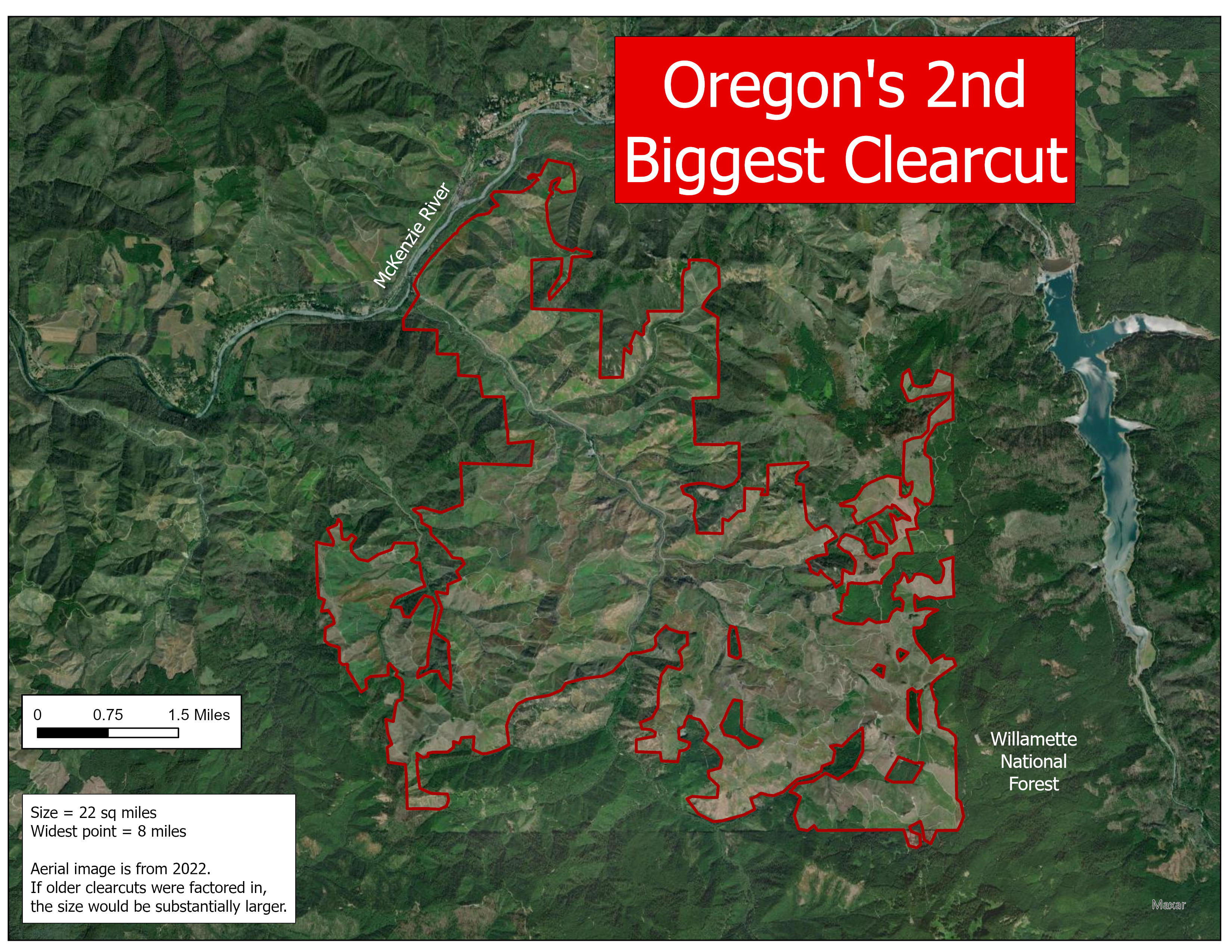
- 2nd biggest clearcut in Oregon map
- Bootleg Fire previously logged/grazed map
- Loafer timber sale map (in relation to proposed Crater Lake Wilderness)
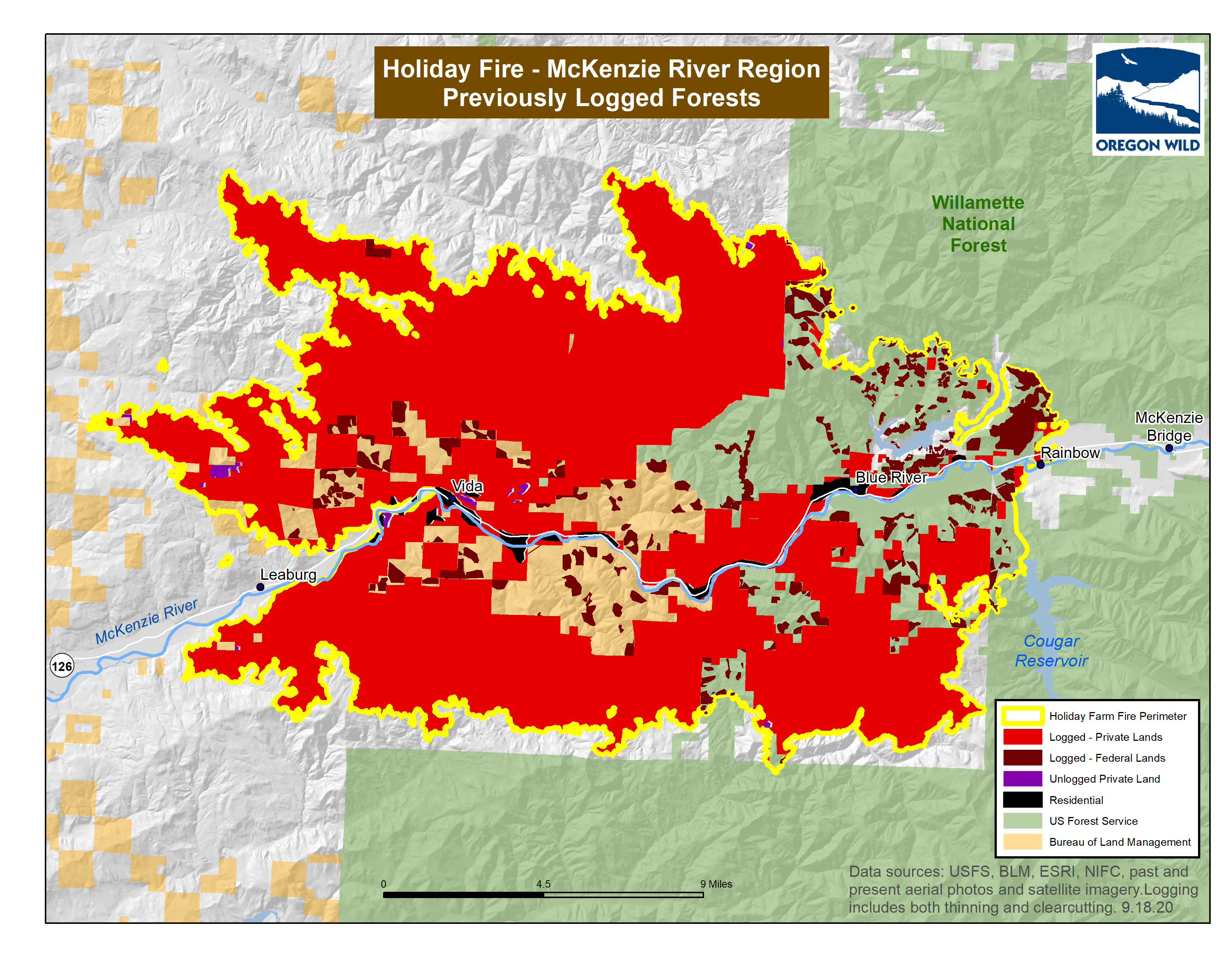
- Holiday Farm 2020 Fire (McKenzie) previously logged forests map
- Current and recent logging projects in Oregon
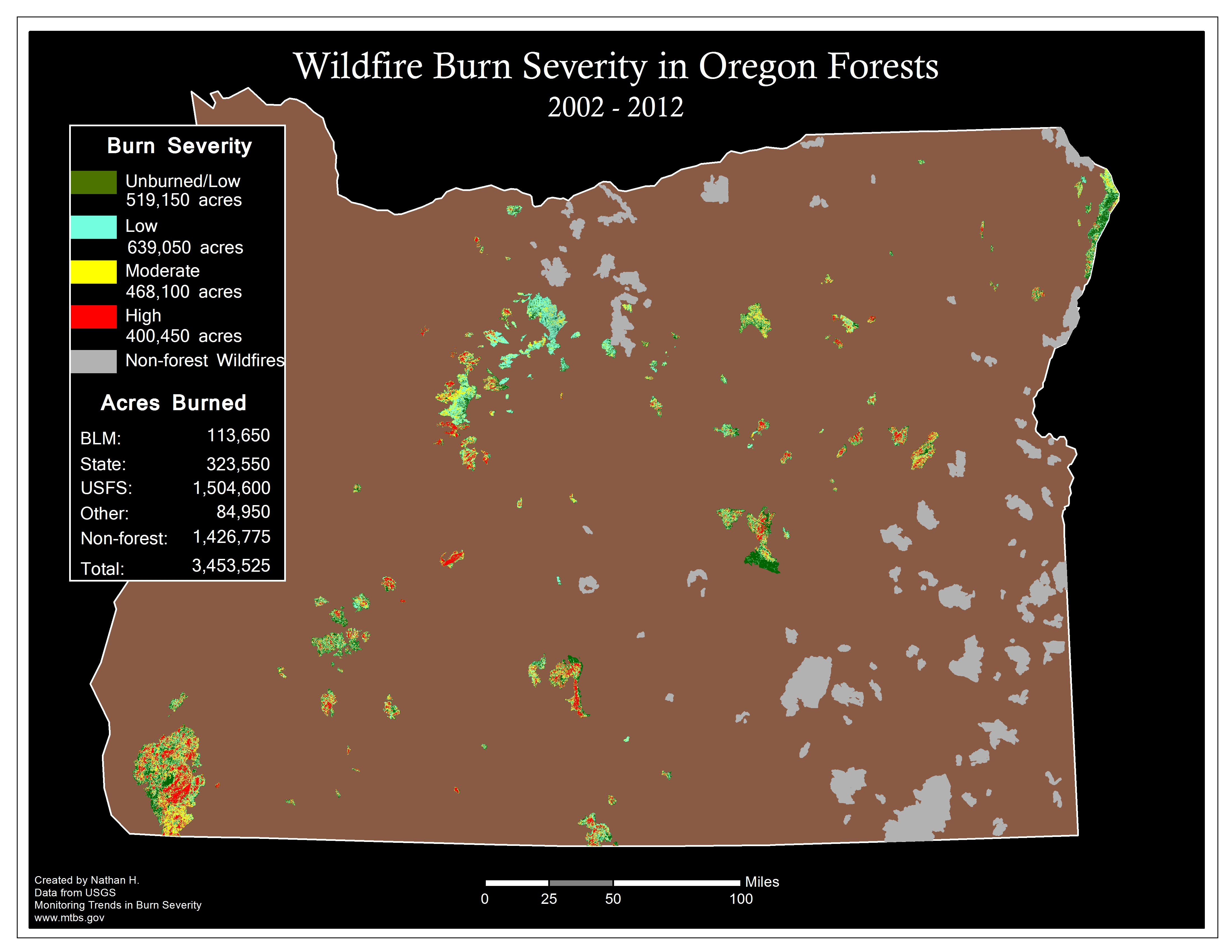
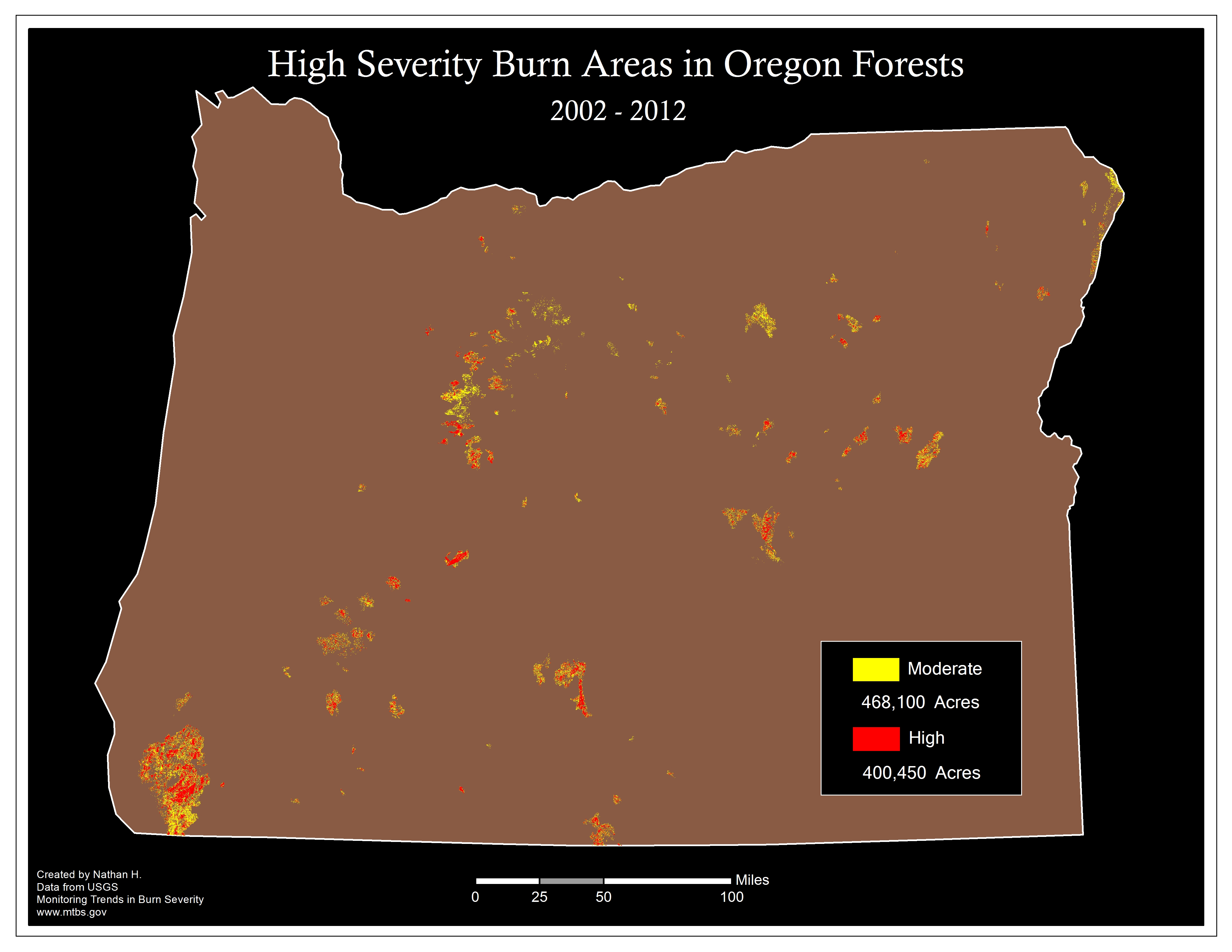
- Map of fire severity from 2002-2012 v1 and v2
- Proposed Logging Mandates for O&C public lands map
- Polallie Cooper Logging Map - Tamanawas Falls
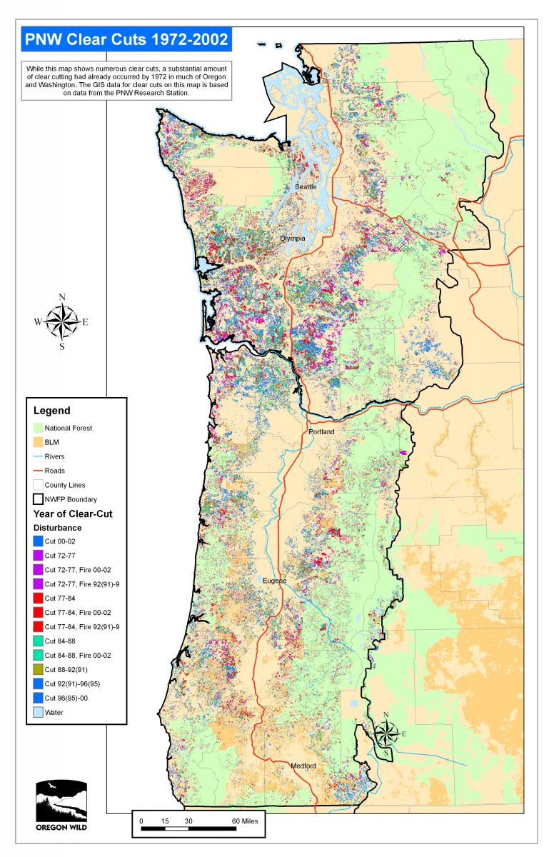
- Northwest Forest Plan area clear-cuts from 1972-2002 (10 mb jpeg)
Other Oregon Maps
- General map of public lands in Oregon
- Drinking watersheds in Oregon including population, backgrounder blog
- Interactive map of old-growth forests
- Interactive map of Oregon's BLM O&C public lands
- Interactive map of Oregon's Wilderness Areas
- Interactive map of Oregon's Inventoried Roadless Areas
- Oregon Redwoods Map
- Oregon Carbon Storage Maps Report
- Mining in Oregon
- Swiss Needle Cast Infected Areas
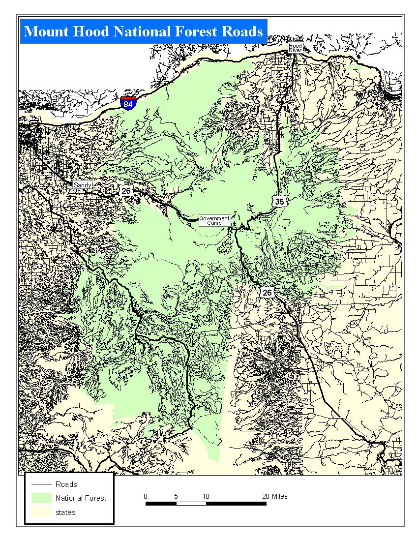
- Mount Hood National Forest Roads Map
- Oregon Forest Types Map
- Black Butte - Glaze Meadow project area map
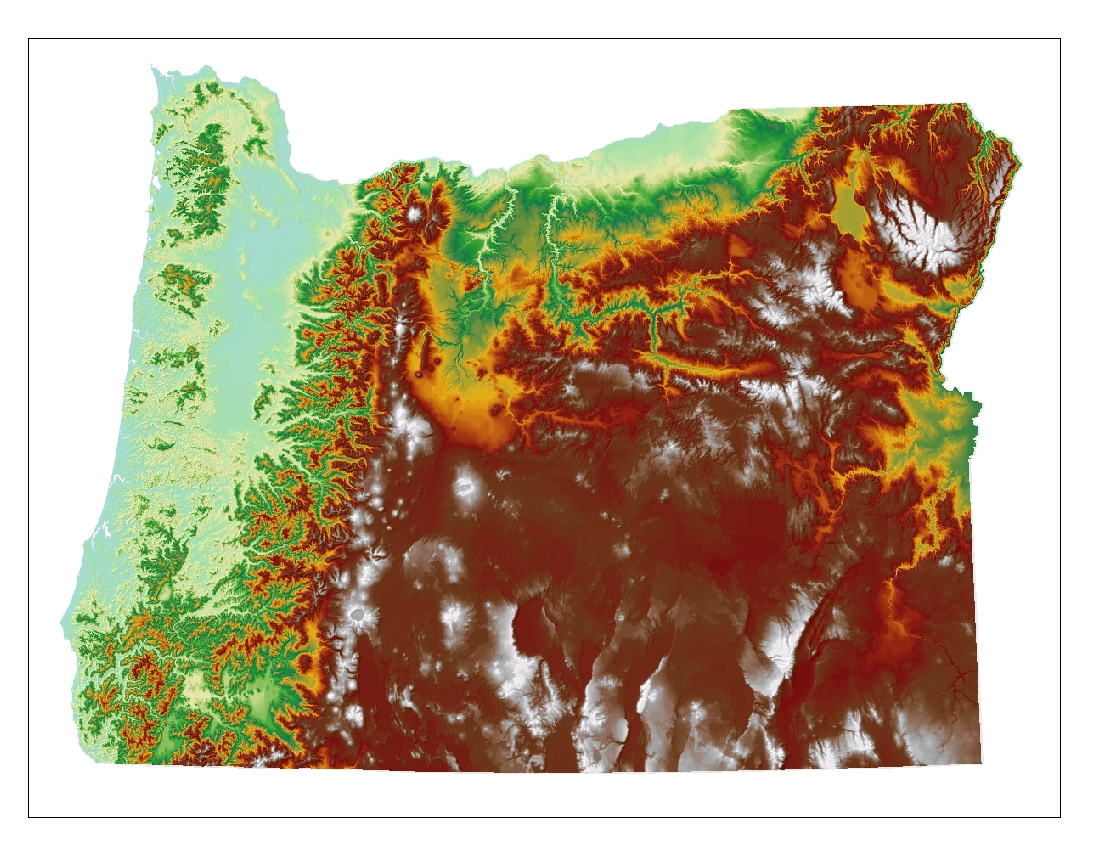
- Oregon Topography Map
- Oregon Section of the Pacific Crest National Scenic Trail
- Oregon Inventoried Roadless Areas

Check back often to see Oregon Wild's newest maps.
All maps are created in ArcGIS, thanks to generous software support from ESRI.
